What Is Midwest Trucking Tracking and How Does It Work?

Midwest trucking tracking gives shippers and carriers a clearer view of where freight is, when it may arrive, and what could delay it. Across long stretches of interstate, a location update can help dispatchers coordinate a driver, a warehouse, and a waiting customer. The details matter: a truck delayed near Chicago can affect a delivery slot several states away. Still, a tracking map is not the same as certainty. Signals can drop, traffic can shift, and estimates can be wrong.

The scale of trucking makes reliable visibility important. The American Trucking Associations reports that trucks moved 72.7% of U.S. domestic freight by weight in 2022, in its American Trucking Trends report. Meanwhile, the American Transportation Research Institute reported an average truck operating cost of about $2.27 per mile in 2023. These figures do not prove that tracking alone reduces costs. They do show why missed appointments, idle equipment, and avoidable delays deserve attention.

This guide explains how Midwest trucking tracking works, from GPS devices and mobile apps to carrier portals and electronic logging systems. It also covers how location data becomes an estimated arrival time, what can interrupt updates, and which questions businesses should ask providers. A practical system may show a truck’s last reported position, route progress, and delivery status. But data quality varies. That part is easy to overlook. Readers should treat tracking as a decision-making aid, not a promise of perfect visibility.
What Is Midwest Trucking Tracking and How Does It Work?

What Midwest Trucking Tracking Means

Midwest trucking tracking is the process of monitoring a shipment as it moves between pickup and delivery points across the region. It may include a current location, estimated arrival time, and updates when a truck reaches a terminal or encounters a delay. The term does not always mean continuous, minute-by-minute GPS access. Some tracking systems update only when a driver or dispatcher records a new milestone. A status marked “in transit” can therefore cover several hours without a precise location.

For a shipper, tracking helps connect a truck’s progress with practical decisions. A warehouse team might prepare a loading bay when an arrival estimate changes, while a receiver can adjust staffing if a delivery runs late. Midwest routes often involve long highway stretches, changing weather, and busy freight hubs. Those conditions can affect estimates. A displayed time is useful, but it is not a guarantee. Even experienced dispatchers sometimes need to revise it.
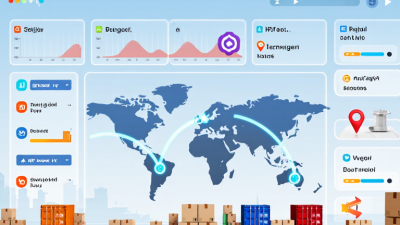
Tips: Check the latest timestamp, not just the shipment status. Ask whether updates are GPS-based or entered at key stops. Save the shipment reference and confirm the delivery window before changing plans. If an update seems stale, contact the carrier or logistics coordinator; tracking data can lag behind the truck.

Key Components of a Truck Tracking System

What Is Midwest Trucking Tracking and How Does It Work?

Key Components of a Truck Tracking System

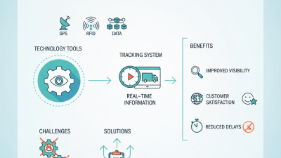
A truck tracking system combines GPS receivers, vehicle sensors, communication networks, and fleet software. The GPS unit estimates a truck’s location using satellite signals. A cellular connection then sends location and vehicle data to a secure platform. Dispatchers can view the truck on a map, check its latest reported position, and compare its route with the planned schedule. In the Midwest, where rural roads and changing weather can affect travel, these details help teams make practical adjustments.

The system may also collect speed, engine status, mileage, and idle time. These readings help fleet managers spot unusual delays or maintenance needs. For example, a rise in engine temperature can prompt a driver to stop safely and request inspection. Not every alert means a serious fault. Data can lag when coverage is weak, and location estimates may not match a truck’s exact position. Human review still matters.

How Truck Tracking Works Step by Step

Midwest truck tracking turns a moving vehicle into a stream of useful location and status updates. A GPS device or an in-cab system records coordinates, then sends them over a cellular or satellite connection to fleet software. A dispatcher sees the truck on a map, alongside its timestamp, route, and reported status. Updates may arrive every few minutes, though coverage gaps can delay them. A dot on a screen is not proof that a delivery has happened.

Step by step, the system gathers a location fix, attaches a time, and transmits the data. Software matches the truck’s position to a route or delivery stop. Dispatchers can compare progress with the planned schedule and contact a driver when a delay needs clarification. At arrival, geofencing can flag that the vehicle entered a defined area; the driver or receiver may still need to confirm the actual handoff.

The American Transportation Research Institute reported an average marginal operating cost of $2.260 per mile for trucking in 2023. That figure is not a tracking benefit, but it shows why accurate trip records matter when reviewing miles and operating costs.

Tips

Check when the last location update arrived before reacting to a stalled map pin. Compare GPS data with driver check-ins and delivery records. Midwest weather and rural dead zones can make tracking imperfect; I’d treat an unexplained gap as a prompt to verify, not as certainty.

Technologies Used to Track Trucks

Midwest truck tracking combines satellite positioning, onboard telematics, cellular networks, and dispatch software. A GPS receiver records a truck’s location; cellular service sends updates to a fleet platform. In areas with weak coverage, such as rural stretches between towns, updates may arrive late. The map can look precise, but it is not always current. GPS.gov notes that GPS-enabled devices typically achieve accuracy within about 4.9 meters under open-sky conditions. Buildings, weather, and equipment placement can reduce accuracy.

More than a moving dot. Telematics units can also report speed, engine faults, fuel use, and harsh braking. Electronic logging devices record driving time and connect with vehicle engines. In its regulatory analysis of the ELD rule, the Federal Motor Carrier Safety Administration estimated 1,844 crashes prevented and 26 lives saved annually. That estimate concerns the rule’s expected effects, not a guarantee for every fleet. Dispatchers use these signals to spot delays, plan safer routes, and give customers more realistic arrival windows. Yet alerts need context: a sudden speed change may reflect a road hazard, not poor driving. Data helps—but people still need to check it.

What Is Midwest Trucking Tracking and How Does It Work?

Truck tracking combines location technologies and connected vehicle data to help fleets monitor vehicles, trailers, and shipments across the Midwest.

How to read this chart: Bars show approximate typical operating ranges in meters, not guaranteed accuracy. GNSS works best outdoors with a clear view of the sky; cellular positioning is less precise; Bluetooth beacons and RFID are typically used for nearby equipment or checkpoint detection. Actual performance varies with equipment, installation, and environment. The logarithmic scale makes these very different ranges easier to compare.

Common Uses and Limitations of Truck Tracking

Truck tracking combines GPS location, vehicle sensors, and dispatch software to show where a truck is and how its trip is progressing. In Midwest operations, dispatchers use it to estimate arrival times, assign nearby loads, and check whether a vehicle has stopped unexpectedly. A map can help. It cannot explain everything. A delayed truck may be waiting at a customer’s dock, not taking an inefficient route.

Tracking can also help managers compare planned and actual routes, review idle time, and locate equipment across a large yard. The American Transportation Research Institute’s 2024 report, An Analysis of the Operational Costs of Trucking, put average operating costs at $2.270 per mile for 2023. That figure is not proof that tracking cuts costs, but it shows why even small routing or utilization changes deserve attention. Results depend on good data and practical follow-up.

There are limits. GPS signals can weaken near tall buildings, under cover, or in remote areas; cellular gaps can delay updates. Location data may also be misleading if a device is poorly installed or trip records are incomplete. Tracking does not replace driver communication, maintenance checks, or accurate delivery records. It can feel precise while still leaving out context. Use it as one operational tool, and verify exceptions before acting.

What Is Midwest Trucking Tracking and How Does It Work? — Common Uses and Limitations of Truck Tracking

Illustrative operating examples, not regional averages. Truck tracking commonly combines GPS location data with cellular or satellite communications and fleet-management software.

Common use How tracking works Illustrative data point Operational benefit Limitation to consider
Live vehicle location An onboard GPS device estimates position and sends updates through a communications network to a tracking platform. A dispatcher views a truck’s latest reported position and timestamp during a route between regional terminals. Helps dispatchers coordinate loads and respond to route changes. Position updates may be delayed or unavailable where cellular coverage is weak; a displayed location is not always instantaneous.
Estimated arrival times The platform compares vehicle progress with the planned route and may account for traffic, stops, and historical travel times. A delivery window is updated when a truck’s progress changes or a delay is reported. Supports dock scheduling and lets receiving teams prepare for arrivals. Severe weather, road closures, construction, and shipper or receiver delays can make estimates inaccurate.
Route and stop monitoring Location history is compared with a planned route, geofences, or expected stop locations. A geofence can record when a vehicle enters or leaves a customer facility’s defined area. Helps identify missed stops, unplanned detours, and arrival or departure times. GPS drift near buildings or poorly configured geofences can create false alerts; a location record does not explain why a stop occurred.
Temperature-sensitive freight A compatible trailer sensor records temperature and sends readings or alerts to the fleet platform. A reefer shipment can be checked against the temperature range specified for that cargo. Provides visibility into reported conditions during transit and may prompt investigation of an excursion. A sensor reading may not represent every part of the load; calibration, placement, connectivity, and reefer-system condition matter.
Hours-of-service and utilization review Fleet systems may combine vehicle location with electronic logging or engine data, subject to device and system capabilities. Managers can compare trip distance, recorded driving time, and vehicle idle periods. Can support planning, compliance workflows, and identification of avoidable idle time. GPS tracking alone does not establish compliance. Records, applicable rules, device configuration, and review procedures still matter.
Safety and incident response Location history and, where installed, vehicle-event data can help teams review an incident or locate a truck. A dispatcher uses the last available location to direct assistance after a driver reports a breakdown. Can speed coordination with drivers, roadside assistance, and operations staff. Tracking does not prevent every incident, replace driver communication, or guarantee coverage and emergency response.

Practical note: Tracking accuracy and update frequency vary by device, network coverage, installation, and service configuration. Use tracking data alongside driver reports and dispatch procedures.