What Is the Best China Truck Tracking Solution?

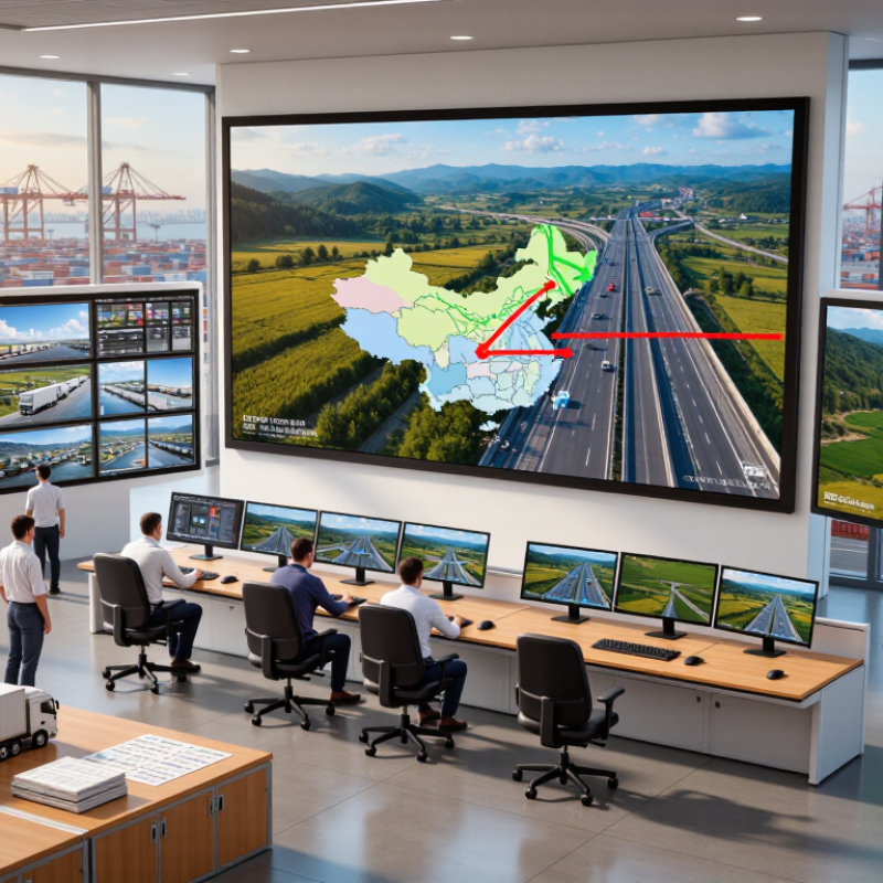
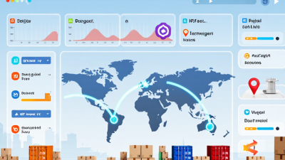
Choosing the best China truck tracking solution is not simply about locating a vehicle on a digital map. Fleet managers need reliable visibility across highways, industrial parks, ports, and remote delivery routes. A suitable platform should support GPS and BeiDou signals, mobile access, geofencing, route playback, and accurate arrival records.

In daily operations, small details matter. A dispatcher may need to confirm whether a truck reached a warehouse gate at 8:40 a.m. Another manager may review sudden braking near a busy junction. These records can improve scheduling, fuel control, and driver safety. They can also reveal repeated delays that a simple spreadsheet would miss. However, truck tracking data is only useful when devices transmit consistently and reports remain easy to understand.

No system is perfect. Signal interruptions, weak hardware installation, or unclear dashboards can reduce confidence. This is where practical testing becomes important. Compare device durability, platform uptime, map coverage, alert speed, customer support, and data protection measures. Ask whether the provider offers transparent service terms and technical assistance within China. A short pilot with several trucks may expose problems earlier than a sales presentation. Independent reviews help, but real fleet experience matters more. The strongest solution is not always the most expensive one. It should fit fleet size, delivery patterns, vehicle types, and management skills. Careful evaluation creates a more dependable tracking process and supports safer, more accountable logistics operations.

What Is the Best China Truck Tracking Solution?

Define China Truck Tracking in a 40.3B-Tonne Road-Freight Market

What Is the Best China Truck Tracking Solution?

Define China Truck Tracking in a 40.3B-Tonne Road-Freight Market

China truck tracking means recording a vehicle’s location, movement, stops, and route progress during freight operations. In a road-freight market moving about 40.3 billion tonnes, visibility must extend beyond a map pin. A practical system combines satellite positioning, cellular updates, geofences, and electronic trip records. It should show whether a truck is moving, waiting, rerouted, or delayed at a loading yard. Small details matter.

Experienced fleet teams use tracking data to improve dispatch decisions and customer communication. An arrival alert can prepare a warehouse before the truck reaches its gate. A long stop may reveal congestion, paperwork delays, or a maintenance concern. Reliable platforms also protect data with access controls, timestamped records, and clear retention rules. Useful data needs context. Location alone cannot explain every delay.

However, no dashboard is perfect. Signal loss, dense urban buildings, tunnels, and device faults can create gaps. Rural roads may produce delayed updates rather than real-time positions. That weakness deserves honest attention. Operators should compare GPS records with driver check-ins, fuel events, delivery documents, and yard observations. Human review still matters. The best solution is not the one with the most alerts. It is the one dispatchers can understand quickly, verify during exceptions, and use consistently across changing routes and vehicle conditions.

Explain the Stack: BeiDou/GPS, 4G/5G, IoT Sensors, and TMS Links

A reliable China truck tracking solution begins with a dual-positioning layer. BeiDou and GPS compare satellite fixes, reducing errors near warehouses, bridges, and dense city blocks. In field deployments, a roof antenna can still lose accuracy beside steel structures. That limitation deserves attention.

Connectivity carries the location data. A 4G modem handles routine updates, while 5G supports faster uploads from cameras, gateways, and high-frequency sensors. GSMA Intelligence reported that 5G represented about 52% of China’s mobile connections at the end of 2023. Yet 5G coverage is not equally strong along every rural route. The device should store records locally and resend them after service returns. Simple, but often missed.

IoT sensors add operational evidence. Door contacts show unauthorized openings, temperature probes protect sensitive cargo, and tire-pressure sensors expose slow leaks. IoT Analytics reported 16.6 billion connected IoT devices worldwide in 2023, showing how quickly sensor-based monitoring is expanding. The tracking gateway should send cleaned data to the TMS, where dispatchers can compare routes, arrival times, fuel use, and delivery exceptions. Open APIs and standard protocols matter more than flashy dashboards. A poorly mapped data field can create false delays. That is an uncomfortable lesson. The best architecture remains testable, redundant, and easy for drivers and technicians to understand.

Compare Platforms for 8M+ Commercial Vehicles and Cross-Province Routes

What Is the Best China Truck Tracking Solution?

For fleets exceeding 8 million commercial vehicles, tracking is more than a moving dot on a map. A practical platform should record location, speed, direction, and stop duration across provinces. It must also handle weak signals, mountain roads, tunnels, and long highway sections. Offline buffering matters when a vehicle loses coverage. Data gaps hurt.

Cross-province routes create operational pressure. Dispatch teams need consistent maps, local road updates, and clear border-crossing alerts. A useful system should show estimated arrival times, route deviations, and unexpected dwell periods. It should support different vehicle types and connect with maintenance or shipment records. Simple screens help busy controllers act quickly.

Reliable platforms need evidence, not impressive demonstrations. Compare historical route accuracy, alert delays, device installation quality, and data recovery rates. Ask for test results from rural and urban routes. Review access controls, audit logs, encryption, and data retention policies. Driver privacy also requires careful handling. No platform is perfect. In practice, false alerts can still appear near logistics hubs or crowded roads. Teams should measure those errors monthly and adjust rules. The best choice is usually the platform that remains stable at scale, explains its limitations, and gives operators usable information during real cross-province journeys.

What Is the Best China Truck Tracking Solution? - Compare Platforms for 8M+ Commercial Vehicles and Cross-Province Routes

A practical comparison of solution types for nationwide commercial-vehicle visibility, multi-province operations, compliance workflows, and fleet optimization.

Evaluation Dimension Basic GNSS Tracking Platform IoT Telematics Platform Fleet Management Platform Transport Management Platform Integrated National Fleet Platform
Primary Use Case Location, route history, and basic anti-theft monitoring Vehicle tracking combined with sensors and driver data Daily dispatch, maintenance, fuel, and driver management Shipment planning, carrier coordination, and delivery execution Unified control across vehicles, shipments, depots, carriers, and provinces
Best-Fit Fleet Size 10–1,000 vehicles 100–10,000 vehicles 500–50,000 vehicles 1,000–100,000 vehicles and subcontracted capacity Multi-region or national fleets with more than 50,000 vehicles
Positioning Technology GNSS positioning, typically using GPS and BeiDou-compatible devices Multi-constellation GNSS with cellular IoT connectivity and sensor inputs GNSS, digital tachograph or onboard terminal data, and mobile applications GNSS data linked with orders, electronic proof of delivery, and carrier systems Multi-source location, vehicle terminals, IoT sensors, APIs, and control-center data
Typical Location Update Interval 30–120 seconds 5–60 seconds 5–30 seconds 10–60 seconds, depending on dispatch needs 5–30 seconds for priority vehicles; configurable by operating zone
Cross-Province Route Visibility Medium
Effective for map-based tracking, but limited operational context
High
Supports route playback, sensor alerts, and border-area monitoring
High
Tracks trips, stops, exceptions, and driver assignments
High
Connects shipment milestones with vehicle movement
Very High
Designed for province-to-province control towers and regional handoffs
Geofencing and Route Rules Basic circular or polygon geofences Geofences with temperature, door, ignition, and idling triggers Restricted roads, service areas, driver routes, and depot rules Route plans linked to pickup, delivery, and appointment windows Hierarchical geofences for provinces, cities, depots, customers, and restricted zones
Compliance and Regulatory Support Location records and basic trip-history export Electronic records, driver behavior events, and device diagnostics Driver, vehicle, inspection, maintenance, and operating-record workflows Transport documents, delivery evidence, exception records, and audit trails Centralized compliance policies with role-based access and long-term evidence retention
Cold-Chain and Cargo Monitoring Limited
Usually requires separate hardware and integration
High
Supports temperature, humidity, door, shock, and power-status sensors
High
Connects sensor alerts to maintenance and dispatch actions
High
Links shipment conditions with delivery milestones
Very High
Supports centralized alert escalation across vehicles and facilities
Driver Behavior Analytics Speeding, harsh braking, and unauthorized-use alerts Speed, acceleration, braking, idling, fatigue indicators, and cornering events Driver scorecards, coaching tasks, safety rankings, and incentive rules Driver performance linked to delivery quality and transport cost Standardized safety KPIs across branches, carriers, and provinces
Fuel and Energy Management Optional fuel-level data and mileage estimates Fuel-level sensors, consumption trends, idling analysis, and EV battery data Fuel reconciliation, mileage controls, maintenance cost, and charging records Fuel or energy cost allocated to orders, routes, and carriers Fleet-wide energy dashboards with regional benchmarking and anomaly detection
Dispatch and Workflow Automation Low
Manual assignment and basic alerts
Medium
Rules-based alerts and task notifications
High
Dispatch boards, driver tasks, maintenance, and exception handling
Very High
Order-to-delivery workflow and carrier collaboration
Very High
Multi-level dispatch with regional control towers and escalation rules
API and System Integration REST API or file export for location and trip data APIs, webhooks, MQTT or device protocols, and sensor integration APIs for ERP, maintenance, fuel, payroll, and identity systems Deep integration with order management, warehouse, billing, and proof-of-delivery systems API gateway, master-data governance, event streaming, and multi-tenant integration
Scalability for 8M+ Vehicles Low to Medium
Suitable only with major infrastructure expansion
Medium to High
Scales well when device and event architecture is optimized
High
Suitable for large enterprise fleets and regional operations
High
Scales through carrier and shipment integrations
Very High
Most appropriate for nationwide, multi-tenant deployment
Data Retention and Auditability Typically 6–24 months, depending on configuration Typically 12–36 months for location and sensor events Multi-year retention for operational, maintenance, and safety records Multi-year retention for shipment, delivery, and settlement records Configurable retention, immutable audit logs, and archive policies by data class
Implementation Complexity Low Medium Medium to High High Very High
Indicative Deployment Timeline 2–8 weeks 1–4 months 3–9 months 6–12 months 12–24 months, usually delivered in phased releases
Recommended Choice Small fleets needing affordable location visibility Fleets requiring real-time vehicle and cargo-condition monitoring Operators prioritizing safety, utilization, maintenance, and dispatch efficiency Logistics networks managing complex orders and multiple transport partners National-scale operations requiring one governance, data, and control framework
Selection guidance: For cross-province trucking, the most practical architecture is usually a telematics layer for reliable vehicle and sensor data, combined with fleet or transport-management workflows. A national-scale deployment should also include BeiDou-compatible positioning, cellular fallback, configurable data retention, API integration, role-based access, and regional control-tower capabilities.
Figures are typical industry planning ranges rather than vendor-specific guarantees; actual performance depends on device quality, cellular coverage, update policy, data retention, and integration scope.

Assess Accuracy, Security, Compliance, and 99.5% Service Availability

A strong China truck tracking solution should be judged by field performance, not attractive dashboards. Accuracy matters. In dense city streets, tall buildings can distort location signals. Tunnels create longer gaps. A practical system should combine satellite positioning, cellular data, and motion sensors. In testing, compare route history with loading records, driver reports, and actual arrival times. Updates every 10 to 30 seconds can help dispatchers detect unexpected stops without overwhelming operators.

Security must protect location data throughout its lifecycle. Use encryption during transmission and storage, role-based access, multi-factor authentication, and detailed audit logs. Logs matter. A dispatcher should see who accessed a vehicle record and when. Data retention should be limited to operational needs, with clear deletion controls. I would not trust a system that treats every employee as an administrator.

Compliance requires more than displaying policy documents. The provider should explain data hosting, user permissions, cross-border transfers, and incident response procedures. Settings should support applicable Chinese requirements and the rules of other operating regions. Independent assessments and documented controls add credibility, but they do not replace regular reviews.

A 99.5% service availability target sounds strong, yet it permits roughly three and a half hours of downtime each month. Ask how availability is measured. Scheduled maintenance, mobile-network failures, and platform outages should be reported separately. No dashboard is perfect. Offline buffering, alert retries, and a human escalation path can keep a single connection failure from becoming a missed delivery.

Select by ROI Against China’s 14.4% Logistics-Cost-to-GDP Ratio

What Is the Best China Truck Tracking Solution?

China’s logistics costs equal about 14.4% of GDP, making visibility a financial decision, not merely a technology upgrade. A strong truck tracking solution should connect location data with measurable savings. Track empty mileage, loading delays, fuel use, route deviations, and delivery exceptions. A dashboard alone is not enough. Operations teams need clear evidence that each alert protects margin or improves service.

Calculate ROI from real operating conditions. Compare current costs with expected savings from fewer idle hours, faster dispatching, and reduced manual calls. For example, a truck waiting three hours outside a warehouse creates labor, fuel, and scheduling losses. Geofencing can identify that delay. However, early ROI forecasts may look too optimistic. Data quality, driver adoption, and weak warehouse processes can reduce the actual return. A small regional pilot may reveal more than a polished presentation.

Tips: Measure baseline costs for four weeks. Test alerts on high-delay routes. Check battery life and signal performance in rural areas. Confirm that managers can export usable reports. Review false alerts every week. Keep the process simple.

The best solution is not the one with the most features. It is the one that links daily transport events to financial outcomes. Teams should also review privacy, access controls, and data retention before deployment. Reliable tracking requires technical accuracy and disciplined follow-up. Even then, improvement will be gradual, and some savings may remain difficult to prove.